
For my mapping assignment, I went somewhat off the rails, both in terms of subject matter, and in the sense that I integrated an element of comparing data on my map. My map, created with QGIS, displays 25 relatively-eastern US states, shows which of them I’ve dreamt about, and how many of my digitally-written pieces mention them.

Why Did I Do This?
I know this idea sounds at the very least unusual, if not entirely unfounded, or even unreasonably arbitrary. However, I find myself thinking a lot about two topics more as of late: the content of my dreams, and my old writing. I think the cause of this is almost certainly related to the fact that the COVID-19 pandemic restricts my ability to interact with others, and so I often find myself thinking about more self-centered matters like these. I took inspiration of the project’s offered second and fourth prompts for this map: dreams, at least in most mainstream schools of thought, are not traditionally able to be mapped, and while even I doubt it sometimes, I can’t deny that I am, at least to some degree, an author, and I have works to my name.
I chose these 25 mostly-eastern states for two reasons: first, sadly, due to the constraints of QGIS, and I know this goes against the project’s first offered prompt. I had some difficulties getting the entirety of the US to render well when I set up a print layout. Second, due to constraints I wanted to set myself. 25 is half the states in the US, and the eastern side covers my home, and most of the places in the country I’ve traveled to physically.
Something that surprises me, looking back, is that this was my initial idea for the project, once I had determined what tool I’d use. I had a feeling that I’d come up with something more substantial or more pertinent to current events, but I suppose this must have spoken to me on some level. Maybe I was partially inspired by some of the work I’ve done in another course, Methods of Text Analysis, where I’ve been using Python to examine aspects of texts such as the number of times words appear in or across them, or the context of those words being used.
The Method
This was my first time working with QGIS, but not my first time mapping something. To be sure, in my line of work, making maps of places that don’t exist is something I have to do very often, and when I first started thinking about this project at all, I thought about doing something along those lines – maybe using one of the mapping tools to create a map of a fictional nation. I quickly realized that this was rather outside my abilities, and I started thinking smaller.
When I first started with QGIS, I mostly experimented with what sorts of files it could take – I thought perhaps I’d have a file lying around my computer somewhere that it could read by chance. After realizing this wasn’t the case, I looked up some tutorials, and went from there, deciding to focus on using a print layout at first. The first challenge I ran into was cutting down on the number of titles, subtitles, markers, errant lines, and names of places from world map I was using. Eventually though, with trial, error, and some guidance from the tutorial, I eventually managed to be successful in this regard.
To gather data, I looked back through personal notes and my own memory to find places I’d dreamt about. Then, I checked through each of the pieces in my collection for mentions of the states I was mapping. I limited my searching to Word document that I’d written entirely myself. The main functions in QGIS I used were pretty simple – I added primarily pictures and text to the map to convey the data I wanted to show. I did encounter a bizarre issue that occurred when attempt to scale certain images, where the images would scale vertically when I was adjusting them horizontally (and vice versa), but with some fiddling, I could usually get them back to normal and then scale them again. Barring that, deleting them and replacing them with an identical image always fixed the problem.

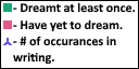
The largest challenge came when trying to add a legend to my map. Maybe I let myself get discouraged too easily, but the built-in function to add a legend was fairly unintuitive to the point where I really wasn’t making much headway at all in trying to get it to convey the information I wanted it to. Thus, I ended up caving, and I created the legend in my image editing software. I then added it as its own image.
Findings
– I’ve dreamt about 12 out of the 25 states I mapped, or roughly half of them.
– The number of pieces the average state was mentioned in: 4.84.
– The number of pieces the average state I’ve dreamt about was mentioned in: 8.25.
– The number of pieces the average state I’ve yet to dream was mentioned in: roughly 1.77.
– In other words, states I’ve dreamt of appear in significantly more of my writing than those that I’ve yet to dream of.
– I’ve mentioned my home state of New York with significantly more frequency than the next most mentioned state – over 4 times more.
– The most common number of mentions was 1.
– There doesn’t appear to be a strong correlational between the size of a state and the number of mentions it’s received: however, very generally, the very smallest states had some of the fewest mentions.
– Similarly, there doesn’t seem to be a strong correlation between the size of a state and whether or not I’ve dreamt of it. However, I’ve dreamt about many of the largest states I mapped.
Closing Words
I’m a little disappointed in myself for choosing such a self-centered project. It might have been more fitting to choose a more relevant or accessible topic than the one I chose. However, in the end, I got to experience QGIS for myself, I ended up with a map that I’m rather proud and fond of, and I enjoyed myself overall. I’m happy to say that I think this won’t be the last time I use QGIS.

This entry is licensed under a Creative Commons Attribution-NonCommercial-NoDerivatives 4.0 International license.